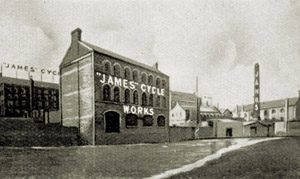
The Geography of the British Motorcycle Industry The British motorcycle industry experienced several major 'waves' of new industry entrants and exits. Two major clusters were the driving force behind the industry, and their individual characteristics were unexpected: a high rate of industry entries and exits, and high level of stability in marque concentration. As the industry matured, the number of small start-up firms declined. During the last of the major waves, technical innovation within the British motorcycle industry slowed just as innovations in the German and Italian motorcycle industries began to increase, resulting in industry stagnation. Marr, Paul. Transport History, In revision. |
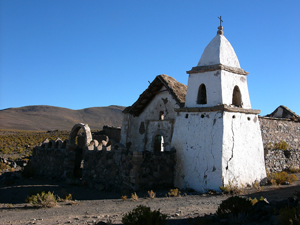
Aymara Village Abandonment in Northern Chile Widespread abandonment of traditional Aymara villages has been observedon the dry puna of northern Chile, with nearly every settlement visited showing signs of permanent abandonment. Settlements have an equal likelihood of being abandoned, regardless of location near or away from wetlands—a critical landscape for Aymara subsistence activities. While abandonment was common, several villages located on routes used by ecotourism showed signs of new construction. That local scale factors have little impact on abandonment indicates that there are broader scale processes at work. We believe that changes in the climate regime, particularly related to the timing of precipitation, and water policy are creating very efficient push mechanisms that operate most effectively (selectively) on, but not limited to, the smallest settlements. Marr, Paul and Claire Jantz, Mountain Research and Development, In review. |
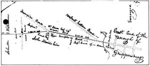
Finding Fort Morris On July 31, 1755, Governor Robert Morris commissioned the construction of two stockade forts, one in Carlisle and one in Shippensburg. Shippensburg’s Fort Morris was one of a line of frontier defenses erected to protect local settlers and garrison provincial troops. While the location of the fort at Carlisle is well documented, there has been much confusion over the location of Shippensburg’s small fort. There are now three locations recognized by various state agencies and local organizations as the site of the fort. This research examined the available historic evidence, paying particular attention to the geographic aspects of the extant documentation, in an attempt to locate the most probable site of Fort Morris. Recent archaeological excavations at the proposed site suggest that the fort was indeed at this location, however the exact positioning of the fort on the landscape remains unknown. Warfel, Stephen and Paul Marr. 2010. The discovery of Fort Morris, Shippensburg, Pennsylvania. Pennsylvania Archaeologist. 80(2): 1-29. Marr, Paul. 2010. In search of Fort Morris. Material Culture. 42(1): 70-83. Marr, Paul. 2004. Finding Fort Morris. Middle States Geographer. 37: 45-52. |
Collapse of the Chilean Nitrate Industry The Atacama Desert of South America contains the world’s only naturally occurring nitrate deposits. Chile’s acquisition of the region following the War of the Pacific (1879-1883) led to a dramatic increase in the country’s revenues as nitrate exports doubled from 3 to 6 million tons per year. With nitrate commanding a price of $50 and export duties amounting to $11.19 per ton in 1914, nitrate exports earned the Chilean government nearly $28 million, or about half of its yearly revenues. With the development of synthetic nitrate in Germany during WWI, Chile’s nitrate mining industry found itself overcapitalized and had begun to suffer the effects of overproduction. By 1931 Chilean nitrate exports had dropped to 1.4 million tons and the price had dropped to $21 per ton and the industry had all but collapsed. |
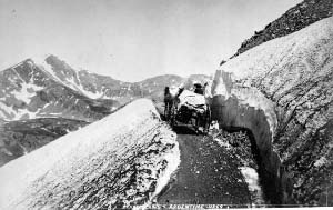
19th
Century Railway Tunnels under the Continental Divide |
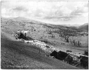
Reconstruction
of a 19th Century Colorado Mining Town |
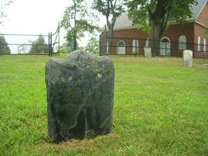
Demographic Reconstruction of Franklin County, Pennsylvania: 1720-1790 Inscriptions from over 1000 individual grave markers were used to reconstruct some of the basic demographic characteristics of Franklin county. Data on age at death; death, birth, and conception date; and ethnicity derived from surnames were recorded for each burial. Results based on analysis of these data suggest that life expectancy was fairly long for those who survived past twenty years. Conception and natality exhibited seasonal characteristics while mortality did not. Men tended to marry later and on average live longer after their spouses died. Finally, towns tended to be more ethnically diverse than rural areas and also exhibited more stable populations. Marr, Paul. 2006. Using Burying Grounds to Reconstruct the Early Demographics of Franklin County, Pennsylvania. Middle States Geographer. 39: 93-100. |
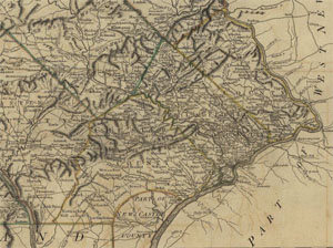
Graph Analysis of William Scull’s 1770 Map of Pennsylvania Although they have been the subject of intense cartographic investigation, few maps colonial American have been systematically investigated using modern network analyses. William Scull’s 1770 map of Pennsylvania offers enough detail to make it a good candidate for such techniques. The map was digitized and examined using graph analyses and other computer base techniques to determine which routes were most important in connecting Philadelphia to its extended hinterlands, which river crossings were most important, and what role did the road network play in the rapid growth and development of Lancaster, the largest inland town at that time. Several important routes to the western frontier were delineated and it was found that Lancaster was located in an area of high accessibility and connectivity. Marr, Paul. 2006. The King’s highway to Lancaster: A graph-theory analysis of colonial Pennsylvania’s road network. Journal of Transport History. 28(1):1-20. |
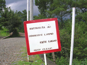
Spanish Language Maintenance in the Meseta Tarasca Since the Spanish conquest of Michoacán, Mexico in the middle 1500s, the Purépecha people and language have experienced significant geographic contraction, and is currently spoken chiefly in the Meseta Purépecha region. While Spanish has become the dominant language in the commercial centers, Purépecha remains an important language and dominant in the countryside. This research examines Spanish language usage and maintenance in the region relative to the degree of accessibility or isolation various towns. The current levels of accessibility, coupled with a new emphasis of teaching Purépecha in school and the erosion of vehicular Spanish throughout one’s life suggests that Purépecha is not a dying language and that Purépecha has geographically stabilized. Ragone, Agnes and Paul Marr. 2006. Language maintenance in the Meseta Purépecha region of Michoacán, Mexico. Anthropological Linguistics. 48(2): 109-131. |
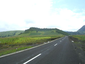
Changes in Tarascan Town Accessibility, 1940-2000 The Meseta Tarasca of Michoacán, Mexico has experienced various transportation improvements over the last several decades. These improvements have had an impact on the manner in which towns interact. Historic trade routes often favored directness over more level and circuitous routes, as burros and horses were the primary mode of transportation. Towns along these routes became important trade centers, and the distribution of population closely mirrored these trade routes. The modern road network did not duplicate some of the more important historic routes, resulting in the abandonment or realignment of the old trade patterns. Places that were once well connected found themselves increasingly isolated in the new transportation network. Marr, Paul and Christopher Sutton. 2007. Changes in accessibility in the Meseta Purépecha region of Michoacán, Mexico: 1940 – 2000. Journal of Transport Geography. 15(6): 465-475. |
The Wiconisco Canal The Wiconisco canal is probably one of the least documented canals in Pennsylvania. Most accounts by early canal chroniclers barely give the canal passing mention, while much of the archival material concerning the canal has either been lost or scattered amongst various state and local historical collections. However, from what information still exists, or at least has been located, a reasonable picture of the workings of this short canal can be compiled. And while the Wiconisco canal may not have been as important as other canals in the broader sense, for a time it was an integral part of upper Dauphin county’s economy. Perhaps more importantly though, examining the Wiconisco canal offers insight to a problem that many rural areas faced—market isolation with respect to a valuable local resource (coal). Marr, Paul and John Burchette. 2008. The Wiconisco canal revisited. Canal History and Technology Proceedings. 27: 5-26. Marr, Paul. 2005. The Wiconisco canal. Canal History and Technology Proceedings. 24: 5-21. |
Demographic Changes in the Tarascan Region of Michoacán, 1970-2000 The "traditional" Tarascan region consists of 18 municipios in northwest Michoacán, Mexico. Since the 1970s this region has undergone several important demographic changes. In particular, the number of Purépecha speakers has grown, rural municipios have been losing population, and urbanization has increased. These demographic changes also suggest that the Tarascan core area is being fractured by recent urban development along two north-south transportation routes. These recent developments will likely have long term impacts on the character of the region. A major component of these changes has been the greater interaction between Michoacán, the rest of Mexico, and the world. Marr, Paul and Christopher Sutton. 2004. Demographic changes in the Purépecha region of Michoacán, Mexico: 1970 – 2000. The Journal of Latin American Geography. 3(1): 52-66. |
Geography of Warehousing and Distribution in South-Central PA The I-81 corridor between Hagerstown, Maryland and Carlisle, Pennsylvania has seen dramatic growth in warehousing and distribution facilities. There are nearly 150 facilities along this 60 mile stretch of interstate highway, with more under construction or in the planning stage. Initially facilities were limited to the interstate connections at Hagerstown and Carlisle, however, recently smaller towns along this stretch of interstate have seen increasing trucking and warehousing development. This research examines the current state of the trucking and warehousing industry in the region and the impacts that are to be expected with continued growth. Fuellhart, Kurt and Paul Marr. 2007.Economic impacts of trucking and warehousing in south-central Pennsylvania. The Pennsylvania Geographer. 45(2): 85-103. Marr, Paul and Eric Mock. 2005. Warehousing in South-Central Pennsylvania’s I-81 corridor: A case study of Exit 29. The Pennsylvania Geographer. 43(1): 1-18. Marr, Paul. 2003. The geography of warehousing and distribution in south-central Pennsylvania. Middle States Geographer. 36:56-65. |
Impacts of Transportation Improvements on Tarascan Craft Industries The Tarascan region has a strong tradition of craft production and as connectivity to the rest of Michoacán increased, cheaper and/or higher-quality products were substituted for locally-produced crafts. Over the course of the last few decades towns throughout the region experienced substantial changes in the types of crafts produced, the extent of their markets, and the location of craft production. Perhaps the most visible change has been the proliferation of storefronts along the main routes in villages on the few major roads through the sierra Many towns have seen a contraction in the types of crafts and an expansion in the volume of the remaining crafts. Marr, Paul and Christopher Sutton. 2004. Impacts of transportation changes on the woodworking industry of Mexico’s Purépecha region. The Geographical Review. 94(4): 440-461. |
Commodity Flow on the Pennsylvania Canal System During the middle 1800s the Pennsylvania canal system allowed raw materials to be moved the urban centers. Perhaps more importantly, the canal system allowed Pennsylvania's nascent rural industries to compete more effectively with their urban counterparts. The flow of goods along the mainline system delineated two distinct geographic separations: the separation between the communities of eastern and far western Pennsylvania, clearly marked by the decrease in the volume of goods shipped across the Portage rail road, and the separation of northern consumers and southern producers of high order goods. Marr, Paul. 2001. Commodity flow on the Pennsylvania Mainline canal. Canal History and Technology Proceedings. 21:107-125. |
Development of 18th Century Overland Trade Routes in the Cumberland Valley of Pennsylvania Overland transportation routes played an important role in the early development of Pennsylvania’s Cumberland Valley. The Virginia path and Raystown path met in the valley and were major regional trade routes. At the junction of these trade routes Shippensburg was envisioned as a trading center that would help to link the eastern plains with the Ohio Valley. Marr, Paul. 2002. Shippensburg and the development of overland transportation in the Cumberland Valley, Pennsylvania in the 1700s. Middle States Geographer.35:101-109. |